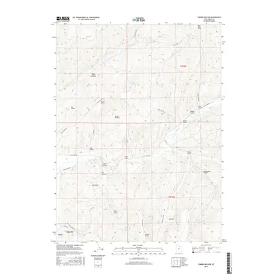
2017 Map of Turner Hollow
USGS Topo · Published 2017About this map
Hoytsville and its local airfield sit at the southwestern edge of this landscape, where the valley floor gives way to the high elevations of the Bear River Range. The terrain is defined by a series of significant canyons and drainage systems, including Chalk Cr and its southern fork, which cut through the high country. Local naming conventions reveal a history of livestock and agricultural utility, with labels such as Turner Meadows, Sage Hollow, and The Meadows indicating established grazing or settlement sites. Transport through these corridors is facilitated by unpaved routes like E Chalk Creek Rd and Clarks Canyon Rd. Geographic landmarks like The Narrows and the Elkhorn Divide highlight the natural bottlenecks and high points that governed movement across this part of Summit County.
Find a feature on this map
38 named features on this map. Tap any name to fly to it.
Don’t see what you’re looking for? This feature index may not catch every label — zoom into the map to look around manually.
Map Details
Editions of this 2017 Turner Hollow Map
This is the sole edition of this map. No revisions or reprints were ever made.
Other maps of this area

1885 · Salt Lake
USGS Topo · 1:250,000

1900 · Coalville
USGS Topo · 1:125,000

1903 · Coalville
USGS Topo · 1:125,000

1954 · Salt Lake City
USGS Topo · 1:250,000

1954 · Ogden
USGS Topo · 1:250,000

1958 · Ogden
USGS Topo · 1:250,000

1958 · Salt Lake City
USGS Topo · 1:250,000

1960 · Ogden
USGS Topo · 1:250,000

1960 · Salt Lake City
USGS Topo · 1:250,000
1964 · Henefer
USGS Topo · 1:24,000