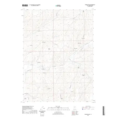
2020 Map of Turner Hollow
USGS Topo · Published 2020About this map
Chalk Cr carves through this high-altitude landscape in the southern Bear River Range, forming a central valley that has long dictated movement and settlement in this part of Summit County. This survey shows the modern configuration of the canyon floor, where The Narrows constricts the waterway between Sage Hollow and Turner Hollow. The naming conventions here, such as Turner Meadows and The Meadows, point to the enduring agricultural value of the relatively level canyon bottomlands surrounded by steep terrain.
Find a feature on this map
32 named features on this map. Tap any name to fly to it.
Don’t see what you’re looking for? This feature index may not catch every label — zoom into the map to look around manually.
Map Details
Editions of this 2020 Turner Hollow Map
This is the sole edition of this map. No revisions or reprints were ever made.
Other maps of this area

1885 · Salt Lake
USGS Topo · 1:250,000

1900 · Coalville
USGS Topo · 1:125,000

1903 · Coalville
USGS Topo · 1:125,000

1954 · Salt Lake City
USGS Topo · 1:250,000

1954 · Ogden
USGS Topo · 1:250,000

1958 · Ogden
USGS Topo · 1:250,000

1958 · Salt Lake City
USGS Topo · 1:250,000

1960 · Ogden
USGS Topo · 1:250,000

1960 · Salt Lake City
USGS Topo · 1:250,000
1964 · Henefer
USGS Topo · 1:24,000