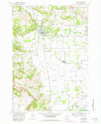
1969 Map of Turner
USGS Topo · Published 1982About this map
Turner and Aumsville serve as the primary hubs in this agricultural landscape within the valley of Mill Creek. The Southern Pacific railroad corridor runs through the center of the sheet, anchoring the development of Turner and the smaller settlement of Marion to the south. The terrain transitions from the elevations of the Waldo Hills and Barnett Knoll in the west to an intricate network of irrigation and drainage infrastructure in the east.
Find a feature on this map
42 named features on this map. Tap any name to fly to it.
Don’t see what you’re looking for? This feature index may not catch every label — zoom into the map to look around manually.
Map Details
Editions of this 1969 Turner Map
3 editions found
Other maps of this area

1912 · Jefferson
USGS Topo · 1:31,680

1915 · Eola
USGS Topo · 1:31,680

1915 · Sidney
USGS Topo · 1:31,680

1916 · Albany
USGS Topo · 1:62,500

1917 · Salem
USGS Topo · 1:62,500

1921 · Lebanon
USGS Topo · 1:62,500

1922 · Lebanon
USGS Topo · 1:48,000

1924 · Lebanon
USGS Topo · 1:62,500

1925 · Stayton
USGS Topo · 1:62,500

1940 · Lebanon
USGS Topo · 1:62,500