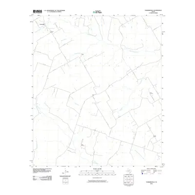
2010 Map of Turnersville
USGS Topo · Published 2010About this map
The Middle Bosque River and its numerous tributaries, including Thorp Branch and Goldys Branch, define the topography of this central Texas landscape. In the northwest corner, the community of Turnersville serves as a primary local landmark, situated near the Turnersville Cemetery. The area is characterized by a sparse network of farm-to-market roads and county routes that connect isolated settlements and family burial grounds across the rolling terrain.
Find a feature on this map
46 named features on this map. Tap any name to fly to it.
Don’t see what you’re looking for? This feature index may not catch every label — zoom into the map to look around manually.
Map Details
Editions of this 2010 Turnersville Map
This is the sole edition of this map. No revisions or reprints were ever made.
Other maps of this area

1888 · Meridian
USGS Topo · 1:125,000

1894 · Meridian
USGS Topo · 1:125,000

1894 · Gatesville
USGS Topo · 1:125,000

1947 · Purmela
USGS Topo · 1:62,500

1947 · Oglesby
USGS Topo · 1:24,000

1947 · Gatesville West
USGS Topo · 1:24,000

1947 · Gatesville East
USGS Topo · 1:24,000
1950 · Gatesville
USGS Topo · 1:62,500

1954 · Waco
USGS Topo · 1:250,000
1954 · Gatesville West
USGS Topo · 1:24,000