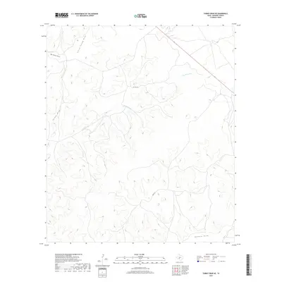
2019 Map of Turney Draw NE
USGS Topo · Published 2019About this map
Dry Devils River carves a winding path across this arid Edwards County landscape, defining the local drainage patterns that have shaped ranching life for generations. The terrain is characterized by a complex network of seasonal watercourses, including Little Turney Draw, Big Turney Draw, and Buffalo Draw, which gather runoff from the surrounding plateaus. Human presence is sparse, marked primarily by isolated access routes like Ingham Ln and Pvt Rd 7640 that thread between the draws. This 2019 survey illustrates the persistent isolation of the Texas Hill Country, where the topographical features and ephemeral water sources continue to dictate the placement of roads and homesteads in a region largely unchanged by modern development.
Find a feature on this map
7 named features on this map. Tap any name to fly to it.
Don’t see what you’re looking for? This feature index may not catch every label — zoom into the map to look around manually.
Map Details
Editions of this 2019 Turney Draw NE Map
This is the sole edition of this map. No revisions or reprints were ever made.
Other maps of this area

1893 · Rock Springs
USGS Topo · 1:125,000

1954 · Sonora
USGS Topo · 1:250,000

1958 · Sonora
USGS Topo · 1:250,000

1963 · Harrison Ranch
USGS Topo · 1:24,000

1967 · Dunbar Draw SW
USGS Topo · 1:24,000

1967 · Dunbar Draw SE
USGS Topo · 1:24,000

1970 · Ray Lake NW
USGS Topo · 1:24,000

1971 · Turney Draw SE
USGS Topo · 1:24,000
1971 · Turney Draw NE
USGS Topo · 1:24,000
1971 · Ray Lake SW
USGS Topo · 1:24,000