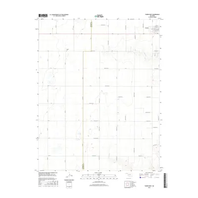
2016 Map of Turpin West
USGS Topo · Published 2016About this map
Nabisco Cem serves as a quiet landmark in this 2016 survey of the Oklahoma Panhandle, located just west of the Texas Co / Beaver Co line. The landscape is defined by the rigid geometry of the section-line road system, featuring routes like K Rd, L Rd, and the north-south corridors of Mile 58 and Mile 59. In the northeast corner, the small community of Turpin marks the intersection of local life and regional transit, situated near the drainage of Sharp Cr. The area is characterized by a high-plains topography, where the grid of county highways such as Co Hwy 8 and Co Hwy 19 overlays the natural drainage features and hollows. This map provides a detailed look at the agricultural patterns and land divisions that have shaped the western edge of Beaver County.
Find a feature on this map
52 named features on this map. Tap any name to fly to it.
Don’t see what you’re looking for? This feature index may not catch every label — zoom into the map to look around manually.
Map Details
Editions of this 2016 Turpin West Map
This is the sole edition of this map. No revisions or reprints were ever made.
Other maps of this area

1954 · Perryton
USGS Topo · 1:250,000

1958 · Perryton
USGS Topo · 1:250,000

1967 · Adams
USGS Topo · 1:24,000

1967 · Tyrone
USGS Topo · 1:24,000

1968 · Hardesty NE
USGS Topo · 1:24,000

1973 · Boyd
USGS Topo · 1:24,000

1973 · Little Ponderosa
USGS Topo · 1:24,000

1973 · Turpin East
USGS Topo · 1:24,000

1973 · Red Horse Creek
USGS Topo · 1:24,000
1973 · Turpin NE
USGS Topo · 1:24,000