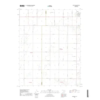
2018 Map of Turpin West
USGS Topo · Published 2018About this map
Turpin sits at the northeast corner of this high-plains landscape, where the town site is organized by local streets like Wheeler and Williams. This survey documents a transition in the Oklahoma Panhandle along the line between Texas Co and Beaver Co, a region defined by its vast agricultural grid and intermittent watercourses. The most significant drainage is Sharp Creek, which winds through the central and eastern sections, creating subtle relief in an otherwise strictly surveyed territory. For those tracing local family history, the Nabisco Cemetery is a notable landmark situated near K Road and Mile 59. The map records an extensive network of rural section-line roads, many of which carry descriptive local names like Hollow E0110 and Hollow N1170, showing how the land was partitioned for homesteading and ranching in the early twenty-first century.
Find a feature on this map
53 named features on this map. Tap any name to fly to it.
Don’t see what you’re looking for? This feature index may not catch every label — zoom into the map to look around manually.
Map Details
Editions of this 2018 Turpin West Map
This is the sole edition of this map. No revisions or reprints were ever made.
Other maps of this area

1954 · Perryton
USGS Topo · 1:250,000

1958 · Perryton
USGS Topo · 1:250,000

1967 · Adams
USGS Topo · 1:24,000

1967 · Tyrone
USGS Topo · 1:24,000

1968 · Hardesty NE
USGS Topo · 1:24,000

1973 · Boyd
USGS Topo · 1:24,000

1973 · Little Ponderosa
USGS Topo · 1:24,000

1973 · Turpin East
USGS Topo · 1:24,000

1973 · Red Horse Creek
USGS Topo · 1:24,000
1973 · Turpin NE
USGS Topo · 1:24,000