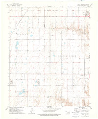
1973 Map of Turpin West
USGS Topo · Published 1976About this map
Nabisco Cem serves as a quiet landmark within the high plains landscape of the Oklahoma Panhandle, situated near the intersection of Texas Co and Beaver Co. The terrain is characterized by broad stretches of Nabisco, Beaver North, and Grand Valley, where the drainage of Sharp Creek cuts through the topography. In the early 1970s, this region remained a productive energy corridor, evidenced by the numerous Oil Wells and Gas Wells scattered across the township grids.
Find a feature on this map
13 named features on this map. Tap any name to fly to it.
Don’t see what you’re looking for? This feature index may not catch every label — zoom into the map to look around manually.
Map Details
Editions of this 1973 Turpin West Map
This is the sole edition of this map. No revisions or reprints were ever made.
Other maps of this area

1954 · Perryton
USGS Topo · 1:250,000

1958 · Perryton
USGS Topo · 1:250,000

1967 · Adams
USGS Topo · 1:24,000

1967 · Tyrone
USGS Topo · 1:24,000

1968 · Hardesty NE
USGS Topo · 1:24,000

1973 · Boyd
USGS Topo · 1:24,000

1973 · Little Ponderosa
USGS Topo · 1:24,000

1973 · Turpin East
USGS Topo · 1:24,000

1973 · Red Horse Creek
USGS Topo · 1:24,000
1973 · Turpin NE
USGS Topo · 1:24,000