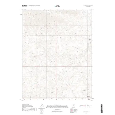
2020 Map of Turtle Canyon
USGS Topo · Published 2020About this map
Range Cr winds through the eastern portion of this Emery County landscape, carving a prominent path amidst a complex network of high-elevation drainages. This recent survey by the U.S. Geological Survey documents the intricate topography of a region defined by its steep elevation changes and deep natural corridors. The drainage pattern shown reflects a terrain where water is the primary architect of the geography, with Range Cr serving as the central hydrological feature for this specific section of the Utah interior. The absence of modern infrastructure or named settlements on this particular quadrangle underscores the undeveloped nature of this corner of the state, focusing entirely on the natural contours and the flow of the creek system.
Find a feature on this map
1 named feature on this map. Tap any name to fly to it.
Don’t see what you’re looking for? This feature index may not catch every label — zoom into the map to look around manually.
Map Details
Editions of this 2020 Turtle Canyon Map
This is the sole edition of this map. No revisions or reprints were ever made.
Other maps of this area

1886 · Price River
USGS Topo · 1:250,000

1896 · Price River
USGS Topo · 1:250,000

1948 · Woodside
USGS Topo · 1:62,500

1949 · Woodside
USGS Topo · 1:62,500

1950 · Woodside
USGS Topo · 1:62,500

1954 · Range Creek
USGS Topo · 1:62,500

1956 · Price
USGS Topo · 1:250,000

1960 · Price
USGS Topo · 1:250,000

1962 · Price
USGS Topo · 1:250,000
1963 · Gunnison Butte
USGS Topo · 1:62,500