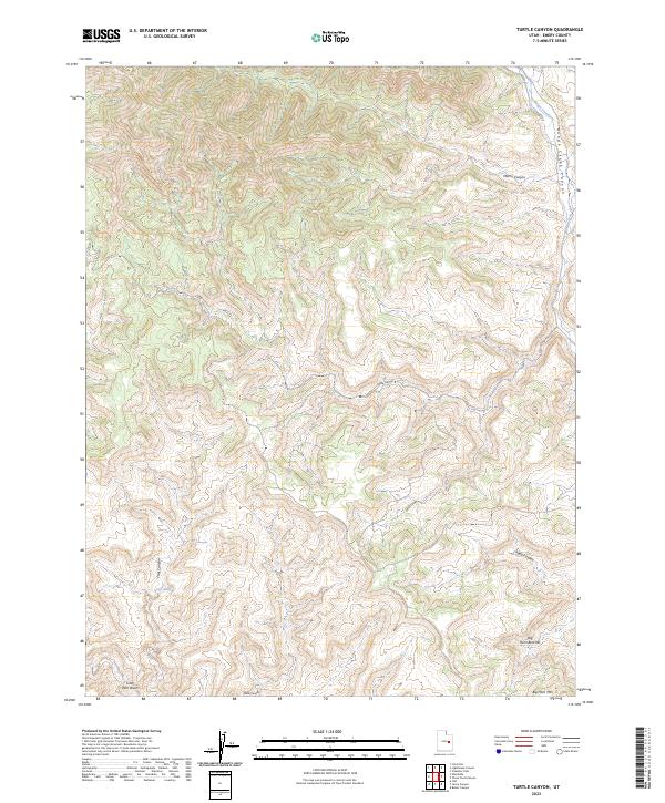
2023 Map of Turtle Canyon
USGS Topo · Published 2023About this map
Big Horn Mtn dominates the southern landscape of this Emery County quadrangle, where high plateaus and deep drainage systems define the high desert geography. The map traces the intricate physical relationship between the Big Horn Benches and the network of canyons that carve through the sedimentary layers of the region. To the north and east, the deep incision of Range Creek Canyon and Range Creek serves as a primary geographical anchor, with local drainages like Mitchs Canyon and Turtle Canyon feeding into the larger system. This terrain is characterized by its isolation and the naming of specific landmarks such as Rabbit Valley and Xmas Canyon, which suggest a history of seasonal use and topographic navigation. The map provides a detailed view of the natural watercourses, including Little Park Wash and Trail Canyon, illustrating how water has historically shaped the travel routes and usable land in this corner of the Utah wilderness.
Find a feature on this map
10 named features on this map. Tap any name to fly to it.
Don’t see what you’re looking for? This feature index may not catch every label — zoom into the map to look around manually.
Map Details
Editions of this 2023 Turtle Canyon Map
This is the sole edition of this map. No revisions or reprints were ever made.
Other maps of this area

1886 · Price River
USGS Topo · 1:250,000

1896 · Price River
USGS Topo · 1:250,000

1948 · Woodside
USGS Topo · 1:62,500

1949 · Woodside
USGS Topo · 1:62,500

1950 · Woodside
USGS Topo · 1:62,500

1954 · Range Creek
USGS Topo · 1:62,500

1956 · Price
USGS Topo · 1:250,000

1960 · Price
USGS Topo · 1:250,000

1962 · Price
USGS Topo · 1:250,000
1963 · Gunnison Butte
USGS Topo · 1:62,500