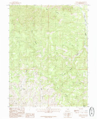
1985 Map of Turtle Canyon
USGS Topo · Published 1985About this map
Joe Spring provides a rare point of water in the high, dry landscape of the Big Horn Benches, located within the remote drainage systems of eastern Emery County. This mid-1980s provisional study documents a region defined by its extreme verticality, where deep cuts like Turtle Canyon and Xmas Canyon carve through the plateau. The drainage of Range Creek marks the eastern boundary, while the massive profile of Big Horn Mountain overlooks the southeastern corner of the quadrangle. Aside from a lone unnamed Trail and the gravel path of Little Park Wash, the map shows a land largely devoid of modern development, focusing instead on the complex network of intermittent watercourses like Mitchs Canyon and the natural corridor of Rabbit Valley. It captures the area in its raw state before further recreational or industrial use altered the primitive access routes.
Find a feature on this map
11 named features on this map. Tap any name to fly to it.
Don’t see what you’re looking for? This feature index may not catch every label — zoom into the map to look around manually.
Map Details
Editions of this 1985 Turtle Canyon Map
This is the sole edition of this map. No revisions or reprints were ever made.
Other maps of this area

1886 · Price River
USGS Topo · 1:250,000

1896 · Price River
USGS Topo · 1:250,000

1948 · Woodside
USGS Topo · 1:62,500

1949 · Woodside
USGS Topo · 1:62,500

1950 · Woodside
USGS Topo · 1:62,500

1954 · Range Creek
USGS Topo · 1:62,500

1956 · Price
USGS Topo · 1:250,000

1960 · Price
USGS Topo · 1:250,000

1962 · Price
USGS Topo · 1:250,000
1963 · Gunnison Butte
USGS Topo · 1:62,500