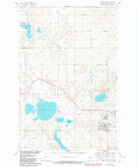
1961 Map of Turtle Lake
USGS Topo · Published 1980About this map
Turtle Lake serves as the focal point of this McLean County survey, which documents the prairie landscape during a period of infrastructure revision. The town itself is a hub for the Burlington Northern railroad, featuring local institutions like the Turtle Lake Cem and several gravel operations. The surrounding terrain is defined by a complex network of glacial potholes and larger bodies of water, including the Lake Nettie National Wildlife Refuge and the expansive Lake Williams. Evidence of early 20th-century rural organization is found in the distribution of schoolhouses such as School No 2 and School No 3, alongside landmarks like St Olaf Ch. The mapping of sloughs and lakes, from Britton Slough to Lake Brekken, highlights the region's hydrology before later environmental shifts and modern agricultural changes altered the shoreline configurations.
Find a feature on this map
24 named features on this map. Tap any name to fly to it.
Don’t see what you’re looking for? This feature index may not catch every label — zoom into the map to look around manually.
Map Details
Editions of this 1961 Turtle Lake Map
2 editions found
Other maps of this area

1929 · Coleharbor
USGS Topo · 1:62,500

1947 · Turtle Lake
USGS Topo · 1:62,500

1949 · Turtle Creek
USGS Topo · 1:62,500

1949 · Washburn
USGS Topo · 1:62,500

1954 · McClusky
USGS Topo · 1:250,000

1958 · McClusky
USGS Topo · 1:250,000

1961 · Turtle Lake
USGS Topo · 1:24,000

1961 · Lake Nettie
USGS Topo · 1:24,000

1961 · Turtle Creek NE
USGS Topo · 1:24,000

1961 · Washburn NE
USGS Topo · 1:24,000