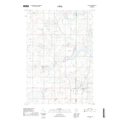
2018 Map of Turtle Lake
USGS Topo · Published 2018About this map
The village of Turtle Lake serves as the primary hub in this corner of Northwest Wisconsin, situated at the boundary of Polk and Barron counties. The landscape is defined by its dense concentration of glacial water bodies, from the sprawling Horseshoe Lake and Echo Lake to smaller basins like Mud Lake and Grass Lake. The Apple River meanders through the central terrain, while the Cattail State Trail follows an established corridor through the countryside, passing just north of the Old Mill Pond.
Find a feature on this map
60 named features on this map. Tap any name to fly to it.
Don’t see what you’re looking for? This feature index may not catch every label — zoom into the map to look around manually.
Map Details
Editions of this 2018 Turtle Lake Map
This is the sole edition of this map. No revisions or reprints were ever made.
Other maps of this area

1950 · Balsam Lake
USGS Topo · 1:62,500

1950 · Turtle Lake
USGS Topo · 1:62,500

1951 · Cumberland
USGS Topo · 1:48,000

1951 · Frederic
USGS Topo · 1:48,000

1952 · Turtle Lake
USGS Topo · 1:62,500

1953 · Stillwater
USGS Topo · 1:250,000

1955 · Frederic
USGS Topo · 1:62,500

1955 · Stillwater
USGS Topo · 1:250,000

1956 · Cumberland
USGS Topo · 1:62,500

1958 · Stillwater
USGS Topo · 1:250,000