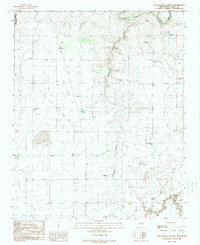
1989 Map of Tuscocoillo Canyon
USGS Topo · Published 1989About this map
Molyneaux Ranch sits at the heart of this high-plains landscape, where the seasonal waters of Arroyo Rana and the deeper carving of Tuscocoillo Canyon dictate the placement of human infrastructure. The map records a ranching economy reliant on a dispersed network of water sources, from windmills like Ealen Windmill and South Woods Windmill to specialized stock-watering points such as Hard Bottom Tank and Collins Tank. This pattern of naming individual wells and tanks provides a clear view of how land was partitioned and managed in Quay County during the late twentieth century.
Find a feature on this map
18 named features on this map. Tap any name to fly to it.
Don’t see what you’re looking for? This feature index may not catch every label — zoom into the map to look around manually.
Map Details
Editions of this 1989 Tuscocoillo Canyon Map
This is the sole edition of this map. No revisions or reprints were ever made.
Other maps of this area

1954 · Tucumcari
USGS Topo · 1:250,000

1958 · Tucumcari
USGS Topo · 1:250,000

1962 · Logan
USGS Topo · 1:62,500

1968 · Porter
USGS Topo · 1:24,000

1968 · Blue Hole
USGS Topo · 1:24,000

1968 · Bard
USGS Topo · 1:24,000

1968 · San Jon NW
USGS Topo · 1:24,000

1968 · Cammak Camp
USGS Topo · 1:24,000
1989 · Logan South
USGS Topo · 1:24,000
1989 · Logan NE
USGS Topo · 1:24,000