
1950 Map of Tustin
USGS Topo · Published 1950About this map
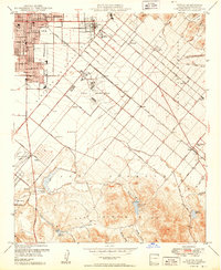
Agricultural grids and developing suburban centers define this landscape at the midpoint of the twentieth century. Santa Ana and Tustin appear as established hubs, while the expansive Naval Reservation occupies a massive central tract, signaling the era's significant military footprint. The Atchison Topeka and Santa Fe railroad cuts diagonally across the coastal plain, facilitating a network of small shipping points like Venta, Frances, and Kathryn. Beyond the citrus groves and farmsteads, the terrain rises into the San Joaquin Hills and Lomas de Santiago, where drainage basins like Peters Canyon Wash and Sand Canyon Wash provide critical water management. The southern edge highlights early aviation and recreation with the Orange County Airport and a cluster of local sporting sites including the La Mesa Gun Club and Sprig Gun Club.
Find a feature on this map
57 named features on this map. Tap any name to fly to it.
Don’t see what you’re looking for? This feature index may not catch every label — zoom into the map to look around manually.
Map Details
Editions of this 1950 Tustin Map
2 editions found
Other maps of this area

1896 · Santa Ana
USGS Topo · 1:62,500

1896 · Anaheim
USGS Topo · 1:62,500

1898 · Anaheim
USGS Topo · 1:62,500

1901 · Southern California Sheet No. 1
USGS Topo · 1:250,000

1901 · Santa Ana
USGS Topo · 1:62,500

1901 · Anaheim
USGS Topo · 1:62,500

1902 · Corona
USGS Topo · 1:125,000

1904 · Southern California Sheet No. 1
USGS Topo · 1:250,000

1932 · Orange
USGS Topo · 1:31,680

1932 · Newport Beach
USGS Topo · 1:31,680