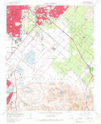
1965 Map of Tustin
USGS Topo · Published 1967About this map
The sprawling campus of the University of California (Irvine) and the Marine Corps Air Facility anchor this mid-1960s view of central Orange County. The landscape is in a state of rapid transition, with residential expansion pushing south from Santa Ana and Tustin toward the open land of the San Joaquin Ranch. Industrial and recreational interests coexist in the southern lowlands, where salt evaporators and duck ponds sit near the Orange County Airport. This era shows the local citrus and agricultural heritage still present at sidings like Irvine (Valencia Siding) and Frances, even as the Santa Ana Freeway and Newport Freeway redefine the region's connectivity. Geologists and local historians will note the numerous gun clubs, such as the Aliso Gun Club and South Coast Gun Club, dotting the unincorporated lands before the full suburban build-out.
Find a feature on this map
83 named features on this map. Tap any name to fly to it.
Don’t see what you’re looking for? This feature index may not catch every label — zoom into the map to look around manually.
Map Details
Editions of this 1965 Tustin Map
2 editions found
Other maps of this area

1896 · Santa Ana
USGS Topo · 1:62,500

1896 · Anaheim
USGS Topo · 1:62,500

1898 · Anaheim
USGS Topo · 1:62,500

1901 · Southern California Sheet No. 1
USGS Topo · 1:250,000

1901 · Santa Ana
USGS Topo · 1:62,500

1901 · Anaheim
USGS Topo · 1:62,500

1902 · Corona
USGS Topo · 1:125,000

1904 · Southern California Sheet No. 1
USGS Topo · 1:250,000

1932 · Orange
USGS Topo · 1:31,680

1932 · Newport Beach
USGS Topo · 1:31,680