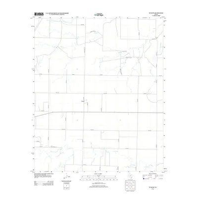
2012 Map of Tuxedo
USGS Topo · Published 2012About this map
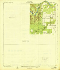
The small settlement of Tuxedo serves as a quiet geographic center in this northern Jones County landscape, where the agricultural grid is defined by an extensive network of farm-to-market and county roads. The terrain is deeply etched by a system of winding waterways including Coon Cr, Paint Cr, and California Cr, which dictate the placement of ranching and farming operations. This 2012 survey captures the area's rural character, anchored by the Flat Top Ranch and the Capron Cem to the northeast. The complex geometry of roads like FM-1661, FM-2834, and numerous numbered county routes illustrates the modern transportation infrastructure required to support this expansive ranching district. The presence of named drainages like Skinout Cr and Thompson Cr further highlights the hydrological importance of these intermittent streams to the local cattle-raising economy.
Find a feature on this map
36 named features on this map. Tap any name to fly to it.
Don’t see what you’re looking for? This feature index may not catch every label — zoom into the map to look around manually.
Map Details
Editions of this 2012 Tuxedo Map
This is the sole edition of this map. No revisions or reprints were ever made.
Other maps of this area
1891 · Anson
USGS Topo · 1:125,000
1893 · Roby
USGS Topo · 1:125,000
1893 · Anson
USGS Topo · 1:125,000
1931 · Aspermont
USGS Topo · 1:62,500

1954 · Lubbock
USGS Topo · 1:250,000

1954 · Big Spring
USGS Topo · 1:250,000

1954 · Abilene
USGS Topo · 1:250,000

1954 · Wichita Falls
USGS Topo · 1:250,000

1958 · Big Spring
USGS Topo · 1:250,000

1958 · Wichita Falls
USGS Topo · 1:250,000