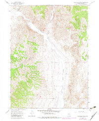
1967 Map of Twelvemile Ranch
USGS Topo · Published 1982About this map
Twelvemile Ranch sits at the confluence of several seasonal drainages in this high-desert Nevada landscape, serving as a focal point for settlement in an area defined by its water sources. The map reveals a land utilized for both ranching and resource extraction, with scattered Prospects and a Borrow Pit indicating local mining interests. The topography is deeply incised by drainages like Twelvemile Canyon and Schoolhouse Canyon, which lead toward the broader valley of Thousand Springs Creek.
Find a feature on this map
16 named features on this map. Tap any name to fly to it.
Don’t see what you’re looking for? This feature index may not catch every label — zoom into the map to look around manually.
Map Details
Editions of this 1967 Twelvemile Ranch Map
2 editions found
Other maps of this area

1955 · Wells
USGS Topo · 1:250,000

1958 · Wells
USGS Topo · 1:250,000

1961 · Wells
USGS Topo · 1:250,000

1961 · Delano Mountains
USGS Topo · 1:62,500

1961 · Dairy Valley
USGS Topo · 1:62,500

1967 · Jackson Spring
USGS Topo · 1:24,000

1967 · Montello Canyon
USGS Topo · 1:24,000

1967 · Twelvemile Ranch
USGS Topo · 1:24,000

1967 · Montello
USGS Topo · 1:24,000

1967 · Ninemile Mtn NE
USGS Topo · 1:24,000