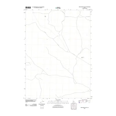
2010 Map of Twentymile Butte
USGS Topo · Published 2010About this map
Twentymile Butte stands as a prominent landmark in this high desert region of Elmore County, overlooking a landscape defined by expansive mesas and deep drainages. The 2010 survey shows a network of remote access roads, including Bell Rapids Rd and Flint Mesa Rd, which traverse the open range. These routes provide the primary connectivity across Flint Mesa to the drainage of Deadman Creek. The map reflects the enduring rural character of this part of southern Idaho, where the geography is shaped by sparse water sources and topographic rises. Researchers can use this record to trace the paths of secondary roads like No Bell Rapids Rd and S Bell Rapids Rd as they existed at the start of the decade.
Find a feature on this map
7 named features on this map. Tap any name to fly to it.
Don’t see what you’re looking for? This feature index may not catch every label — zoom into the map to look around manually.
Map Details
Editions of this 2010 Twentymile Butte Map
This is the sole edition of this map. No revisions or reprints were ever made.
Other maps of this area

1947 · Glenns Ferry
USGS Topo · 1:24,000

1947 · Pasadena Valley
USGS Topo · 1:24,000

1948 · Pasadena Valley
USGS Topo · 1:24,000

1948 · Glenns Ferry
USGS Topo · 1:24,000

1948 · Twentymile Butte
USGS Topo · 1:24,000

1948 · Glenns Ferry
USGS Topo · 1:62,500

1948 · Ticeska
USGS Topo · 1:24,000

1948 · Grindstone Butte
USGS Topo · 1:24,000
1949 · Grindstone Butte
USGS Topo · 1:24,000

1949 · Ticeska
USGS Topo · 1:24,000