
2020 Map of Twentymile Creek
USGS Topo · Published 2020About this map
Paradise Valley sits at the northern edge of this high-elevation landscape, where the agricultural flats meet the rising slopes of the Cabinet Mountains. Most of the terrain is managed as part of the Kaniksu National Forest, a region defined by steep drainages and prominent summits like Twentymile Peak and Jay Peak. The hydrography of the area is dominated by the namesake Twentymile Creek and its many tributaries, including Contrary Creek and Cone Creek, which carve through the dense forest towards the valley floor. A complex network of forestry access routes, such as Natl Forest Develop Road 2617 Rd, crisscrosses the slopes, providing access to remote points like Twentymile Pass. In the southwest corner, Beaver Lake lies near the base of Sand Mtn, representing one of the few standing water bodies in this drainage-heavy mountain environment.
Find a feature on this map
55 named features on this map. Tap any name to fly to it.
Don’t see what you’re looking for? This feature index may not catch every label — zoom into the map to look around manually.
Map Details
Editions of this 2020 Twentymile Creek Map
This is the sole edition of this map. No revisions or reprints were ever made.
Other maps of this area
1911 · Priest Lake
USGS Topo · 1:250,000
1913 · Priest Lake
USGS Topo · 1:250,000
1951 · Mt Pend Oreille
USGS Topo · 1:62,500
1951 · Elmira
USGS Topo · 1:62,500

1958 · Sandpoint
USGS Topo · 1:250,000

1963 · Sandpoint
USGS Topo · 1:250,000
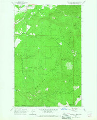
1965 · Twentymile Creek
USGS Topo · 1:24,000
1965 · Moravia
USGS Topo · 1:24,000
1965 · Moyie Springs
USGS Topo · 1:24,000
1965 · Naples
USGS Topo · 1:24,000