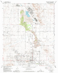
1973 Map of Twentynine Palms
USGS Topo · Published 1994About this map
Twentynine Palms serves as a critical desert crossroads in the early 1970s, where residential expansion meets the expansive Marine Corps Air Ground Combat Center. The map captures a transition point between the established town center and outlying developments like Harmony Acres and Desert Heights. A distinctive north-south corridor of Sand Dunes separates the municipal core from the dry bed of Mesquite Lake, while the Oasis of Mara and the Joshua Tree N M Hdqrs anchor the southern boundary near the national monument. Local genealogy is supported by the identification of the Twentynine Palms Cem and the Indian Cem, alongside numerous schools and local landmarks like The Plaza and Four Corners. The landscape is defined by its water management and infrastructure, from the Sewage Disposal Ponds to remote wells and the Mesquite Spring.
Find a feature on this map
52 named features on this map. Tap any name to fly to it.
Don’t see what you’re looking for? This feature index may not catch every label — zoom into the map to look around manually.
Map Details
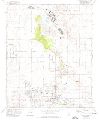
Editions of this 1973 Twentynine Palms Map
2 editions found
Other maps of this area

1942 · Amboy
USGS Topo · 1:250,000

1943 · Amboy
USGS Topo · 1:250,000

1953 · San Bernardino
USGS Topo · 1:250,000

1954 · Needles
USGS Topo · 1:250,000

1954 · Valley Mtn
USGS Topo · 1:24,000

1955 · Deadman Lake SE
USGS Topo · 1:24,000

1955 · Deadman Lake SW
USGS Topo · 1:24,000

1955 · Lead Mountain SW
USGS Topo · 1:24,000

1955 · Twentynine Palms
USGS Topo · 1:24,000

1955 · Twentynine Palms
USGS Topo · 1:62,500
Featured Places
- Twentynine Palms, CA
- Smoke Tree, Twentynine Palms
- Harmony Acres, Twentynine Palms
- San Bernardino County, CA
- United States