
1951 Map of Twentyone Divide
USGS Topo · Published 1953About this map
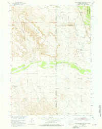
The Cheyenne River carves through the landscape of the Wyoming and South Dakota border, a region defined by its complex drainage systems and high ridges. In the early 1950s, this area served as a remote intersection of ranching and early transit infrastructure, where the Chicago Burlington and Quincy railroad line tracks across the northeastern corner. The local community is anchored by the Cheyenne River School, a vital social and educational landmark for the scattered population living near Twentyone Divide. To the north, Beaver Creek and Lone Tree Creek feed into the river system, while an Artesian Well indicates the essential reliance on groundwater in this arid environment. The map also captures the edge of the Harney National Forest, providing a detailed look at the public lands and county boundaries where Niobrara, Fall River, and Custer Counties meet along the Black Hills Meridian.
Find a feature on this map
13 named features on this map. Tap any name to fly to it.
Don’t see what you’re looking for? This feature index may not catch every label — zoom into the map to look around manually.
Map Details
Editions of this 1951 Twentyone Divide Map
2 editions found
Other maps of this area

1896 · Harney Peak
USGS Topo · 1:125,000

1899 · Newcastle
USGS Topo · 1:125,000

1901 · Harney Peak
USGS Topo · 1:125,000

1901 · Newcastle
USGS Topo · 1:125,000

1902 · Edgemont
USGS Topo · 1:125,000

1950 · Edgemont SW
USGS Topo · 1:24,000

1950 · Burdock
USGS Topo · 1:24,000

1951 · Dewey
USGS Topo · 1:24,000

1951 · Dewey SW
USGS Topo · 1:24,000
1954 · Jewel Cave SW
USGS Topo · 1:24,000