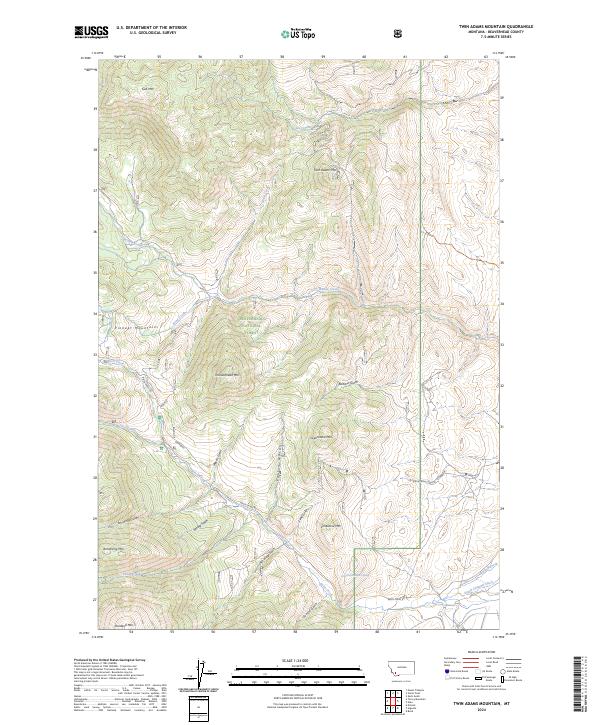
2024 Map of Twin Adams Mountain
USGS Topo · Published 2024About this map
Beaverhead National Forest encompasses the high country of the Pioneer Mountains in this modern survey. The terrain is defined by a series of prominent summits, including Twin Adams Mtn, Thunderhead Mtn, and Humbolt Mtn, which overlook a network of steep drainages. These waters, such as Willow Creek and Birch Creek, have carved numerous gulches across the landscape, including Barbour Gulch and Meyers Gulch. Human infrastructure is largely confined to the southern portion of the quadrangle, where Birch Creek Rd provides access to the interior. The presence of the South Channel Ditch and the 05S10W02DABB01 Spring suggests the critical role of water management and natural sources in this high-altitude environment, serving both ecological and potential agricultural needs downstream.
Find a feature on this map
34 named features on this map. Tap any name to fly to it.
Don’t see what you’re looking for? This feature index may not catch every label — zoom into the map to look around manually.
Map Details
Editions of this 2024 Twin Adams Mountain Map
This is the sole edition of this map. No revisions or reprints were ever made.
Other maps of this area

1893 · Dillon
USGS Topo · 1:250,000

1952 · Twin Adams Mountain
USGS Topo · 1:24,000

1952 · Argenta
USGS Topo · 1:24,000

1952 · Torrey Mountain
USGS Topo · 1:24,000

1952 · Ermont
USGS Topo · 1:24,000

1955 · Dillon
USGS Topo · 1:250,000

1957 · Dillon
USGS Topo · 1:250,000

1958 · Dillon
USGS Topo · 1:250,000

1958 · Vipond Park
USGS Topo · 1:62,500

1960 · Glen
USGS Topo · 1:24,000