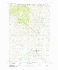
1960 Map of Twin Bridges
USGS Topo · Published 1986About this map
The confluence of the Big Hole River, Beaverhead River, and Ruby River marks a vital hydrologic junction in this 1960s survey of southern Montana. These waters merge to form the Jefferson River just north of Twin Bridges, a town defined by its river-valley location and the tracks of the Northern Pacific railroad. The landscape shifts abruptly from the fertile river bottoms and sloughs, such as Schoolhouse Slough, to the high elevations of the Highland Mountains and the Deerlodge National Forest in the northwest.
Find a feature on this map
71 named features on this map. Tap any name to fly to it.
Don’t see what you’re looking for? This feature index may not catch every label — zoom into the map to look around manually.
Map Details
Editions of this 1960 Twin Bridges Map
3 editions found
Other maps of this area

1893 · Dillon
USGS Topo · 1:250,000

1955 · Dillon
USGS Topo · 1:250,000

1957 · Dillon
USGS Topo · 1:250,000

1958 · Dillon
USGS Topo · 1:250,000

1960 · Block Mountain
USGS Topo · 1:24,000

1960 · Twin Bridges
USGS Topo · 1:62,500

1960 · Waterloo
USGS Topo · 1:62,500

1961 · Wickiup Creek
USGS Topo · 1:24,000

1961 · Nez Perce Hollow
USGS Topo · 1:24,000

1961 · Butte South
USGS Topo · 1:62,500