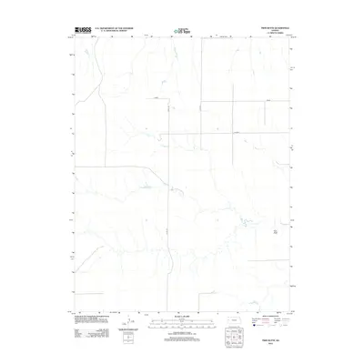
2012 Map of Twin Butte
USGS Topo · Published 2012About this map
Twin Butte rises as a prominent landmark in the expansive high plains landscape of western Kansas, where the terrain is etched by seasonal drainage patterns and a strictly organized grid of rural corridors. The map documents a sparsely settled region defined by its connectivity, showing major local thoroughfares like Kiowa and Jayhawk which facilitate movement through this agricultural heartland. Unlike many areas with clustered townships, this portion of Wallace County is characterized by large-scale land management, where the presence of routes such as Co Rd-120 and Co Rd-139 underscores the systematic surveying of the American West. The topographic detail reveals the subtle elevation changes that define the drainage basins surrounding the eponymous butte, providing a precise record of the physical geography as it existed in 2012.
Find a feature on this map
5 named features on this map. Tap any name to fly to it.
Don’t see what you’re looking for? This feature index may not catch every label — zoom into the map to look around manually.
Map Details
Editions of this 2012 Twin Butte Map
This is the sole edition of this map. No revisions or reprints were ever made.
Other maps of this area

1955 · Scott City
USGS Topo · 1:250,000

1958 · Scott City
USGS Topo · 1:250,000

1959 · Wallace
USGS Topo · 1:62,500

1968 · Russell Springs 3 NW
USGS Topo · 1:24,000

1968 · Sharon Springs 4 NE
USGS Topo · 1:24,000

1968 · Russell Springs 3 NE
USGS Topo · 1:24,000

1969 · Russell Springs 2 NW
USGS Topo · 1:24,000

1969 · Russell Springs 2 SW
USGS Topo · 1:24,000

1969 · Russell Springs 2 NE
USGS Topo · 1:24,000

1969 · Russell Springs 2 SE
USGS Topo · 1:24,000