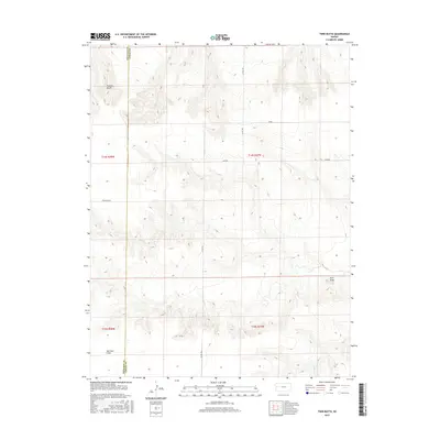
2015 Map of Twin Butte
USGS Topo · Published 2015About this map
Wallace Bluffs rise above the high plains of western Kansas in this study of the borderlands between Wallace and Logan counties. The landscape is characterized by its dramatic topography, featuring the namesake Twin Butte and the broad, level expanse of Harrison Flats. This era of the territory is defined by a sparse but organized road network, including Ironhorse Rd and several county routes that segment the vast ranching or agricultural tracts. The map identifies specific areas named Jayhawk and Kiowa, indicating localized geographic identities within the townships of T14S and T15S. This survey provides a precise record of the land's contours and the transition from rugged breaks to flat tablelands in a sparsely populated region of the state.
Find a feature on this map
14 named features on this map. Tap any name to fly to it.
Don’t see what you’re looking for? This feature index may not catch every label — zoom into the map to look around manually.
Map Details
Editions of this 2015 Twin Butte Map
This is the sole edition of this map. No revisions or reprints were ever made.
Other maps of this area

1955 · Scott City
USGS Topo · 1:250,000

1958 · Scott City
USGS Topo · 1:250,000

1959 · Wallace
USGS Topo · 1:62,500

1968 · Russell Springs 3 NW
USGS Topo · 1:24,000

1968 · Sharon Springs 4 NE
USGS Topo · 1:24,000

1968 · Russell Springs 3 NE
USGS Topo · 1:24,000

1969 · Russell Springs 2 NW
USGS Topo · 1:24,000

1969 · Russell Springs 2 SW
USGS Topo · 1:24,000

1969 · Russell Springs 2 NE
USGS Topo · 1:24,000

1969 · Russell Springs 2 SE
USGS Topo · 1:24,000