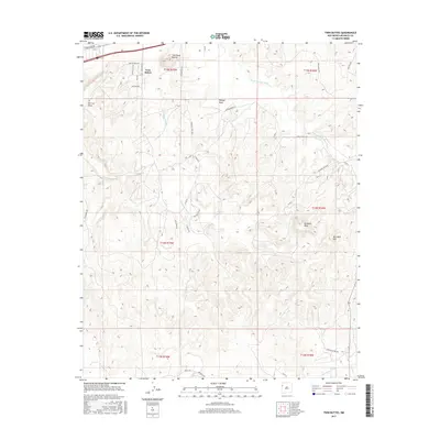
2017 Map of Twin Buttes
USGS Topo · Published 2017About this map
Torrivio Mesa and the prominent volcanic landmarks of the Twin Buttes dominate this McKinley County landscape, where the high desert meets a complex network of drainage basins. The area is characterized by several ephemeral watercourses, including Bread Springs Wash and Salt Water Wash, which have carved deep paths through the sandstone and shale. High-elevation features like Refuge Rock and Remnant Mesa overlook a grid of county and tribal roads, reflecting the modern connectivity of this southwestern region. Local thoroughfares such as Torrivio Mesa Rd and Skeets Rd weave between the mesas, providing access to the various range and townships. This survey illustrates how contemporary road systems, such as Frontage Rd, have been integrated into a landscape defined by traditional geological landmarks like Red Rock Hill and Twin Knoll Buttes.
Find a feature on this map
36 named features on this map. Tap any name to fly to it.
Don’t see what you’re looking for? This feature index may not catch every label — zoom into the map to look around manually.
Map Details
Editions of this 2017 Twin Buttes Map
This is the sole edition of this map. No revisions or reprints were ever made.
Other maps of this area

1886 · Wingate
USGS Topo · 1:250,000

1892 · Wingate
USGS Topo · 1:250,000

1954 · Gallup
USGS Topo · 1:250,000

1958 · Gallup
USGS Topo · 1:250,000

1959 · Gallup
USGS Topo · 1:250,000

1962 · Gallup
USGS Topo · 1:250,000

1963 · Twin Buttes
USGS Topo · 1:24,000

1963 · Gallup West
USGS Topo · 1:24,000

1963 · Manuelito
USGS Topo · 1:24,000

1963 · Jones Ranch School
USGS Topo · 1:24,000
Featured Places
- Gallup, NM
- Eastern Navajo Agency, NM
- Williams Acres, NM
- Red Rock, Eastern Navajo Agency
- McKinley County, NM