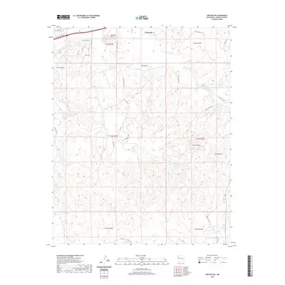
2020 Map of Twin Buttes
USGS Topo · Published 2020About this map
The high desert landscape south of Gallup is defined by a series of prominent mesas and dry watercourses that reflect the arid geology of McKinley County. Dominating the northern terrain are the steep profiles of Torrivio Mesa and Twin Knoll Buttes, which overlook a network of ephemeral drainages including Twin Buttes Wash and Bread Springs Wash. The survey illustrates a transition from the developing outskirts of the city, marked by residential roads like Williams Acres Rd and Sierra Vista Dr, into the more open, traditional land divisions of the surrounding townships.
Find a feature on this map
36 named features on this map. Tap any name to fly to it.
Don’t see what you’re looking for? This feature index may not catch every label — zoom into the map to look around manually.
Map Details
Editions of this 2020 Twin Buttes Map
This is the sole edition of this map. No revisions or reprints were ever made.
Other maps of this area

1886 · Wingate
USGS Topo · 1:250,000

1892 · Wingate
USGS Topo · 1:250,000

1954 · Gallup
USGS Topo · 1:250,000

1958 · Gallup
USGS Topo · 1:250,000

1959 · Gallup
USGS Topo · 1:250,000

1962 · Gallup
USGS Topo · 1:250,000

1963 · Twin Buttes
USGS Topo · 1:24,000

1963 · Gallup West
USGS Topo · 1:24,000

1963 · Manuelito
USGS Topo · 1:24,000

1963 · Jones Ranch School
USGS Topo · 1:24,000
Featured Places
- Gallup, NM
- Eastern Navajo Agency, NM
- Williams Acres, NM
- Red Rock, Eastern Navajo Agency
- McKinley County, NM