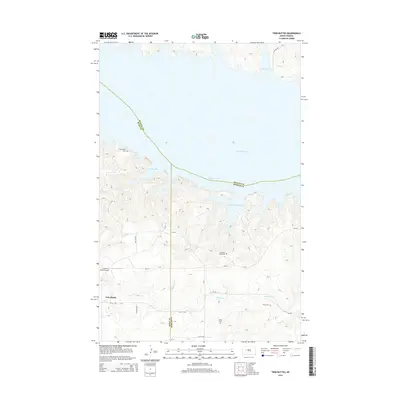
2014 Map of Twin Buttes
USGS Topo · Published 2014About this map
Lake Sakakawea dominates this landscape, covering a wide expanse of the Missouri River valley where it meets the borders of Dunn, McLean, and Mercer counties. The shoreline is deeply etched by numerous inlets, including Mandan Bay, Medicine Stone Bay, and Elbowoods Bay. These waters cover much of the historic floodplain, leaving only the higher elevations to accommodate the modern community of Twin Buttes and the surrounding ranching operations.
Find a feature on this map
23 named features on this map. Tap any name to fly to it.
Don’t see what you’re looking for? This feature index may not catch every label — zoom into the map to look around manually.
Map Details
Editions of this 2014 Twin Buttes Map
This is the sole edition of this map. No revisions or reprints were ever made.
Other maps of this area

1953 · Watford City
USGS Topo · 1:250,000

1957 · Watford City
USGS Topo · 1:250,000

1967 · Watford City
USGS Topo · 1:250,000

1967 · Raub SE
USGS Topo · 1:24,000

1967 · Raub NW
USGS Topo · 1:24,000

1967 · Raub
USGS Topo · 1:24,000

1967 · Twin Buttes
USGS Topo · 1:24,000

1970 · Halliday NE
USGS Topo · 1:24,000

1970 · Hay Flat
USGS Topo · 1:24,000
1970 · Golden Valley NE
USGS Topo · 1:24,000