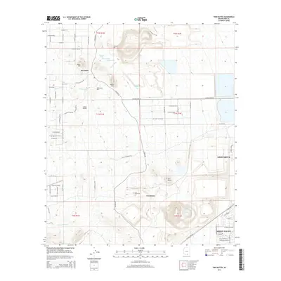
2014 Map of Twin Buttes
USGS Topo · Published 2014About this map
Helmet Peak and Mineral Hill dominate the skyline of this Pima County landscape, where the traditional settlement of San Xavier meets modern aviation and suburban expansion. The terrain is defined by a network of drainage channels, including Marjorie Wash, Rodolfo Wash, and Angelica Wash, which cut through the high desert floor between prominent elevations like Whitcomb Hill and the double-peaked Twin Buttes. Aviation is a central theme in this 2014 survey, which documents the Flying Diamond Airport and the Ruby Star Airpark alongside the growing residential grids of Sahuarita and Green Valley. Notable cultural landmarks include the Twin Buttes Cem and the intriguing label for Indian Kitchen, providing specific points of interest for genealogists and local historians tracking the evolution of the Santa Cruz Valley region.
Find a feature on this map
71 named features on this map. Tap any name to fly to it.
Don’t see what you’re looking for? This feature index may not catch every label — zoom into the map to look around manually.
Map Details
Editions of this 2014 Twin Buttes Map
This is the sole edition of this map. No revisions or reprints were ever made.
Other maps of this area

1904 · Patagonia
USGS Topo · 1:125,000

1904 · Tucson
USGS Topo · 1:125,000

1905 · Patagonia
USGS Topo · 1:125,000

1905 · Tucson
USGS Topo · 1:125,000

1920 · Arivaca
USGS Topo · 1:125,000

1925 · Samaniego Peak
USGS Topo · 1:62,500

1925 · San Xavier
USGS Topo · 1:62,500

1926 · Helvetia
USGS Topo · 1:62,500

1934 · Tucson Mountains
USGS Topo · 1:125,000

1939 · Twin Buttes
USGS Topo · 1:62,500