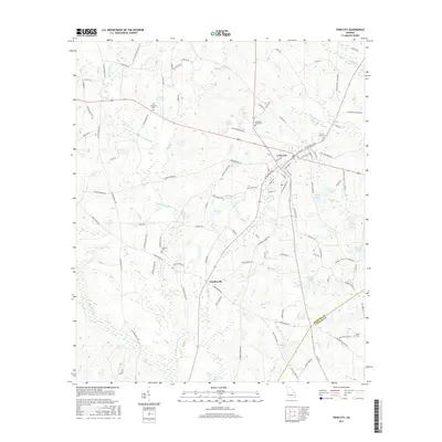
2017 Map of Twin City
USGS Topo · Published 2017About this map
Twin City serves as the primary hub in this portion of Emanuel County, where local life is defined by a landscape of creeks and small lakes. The area exhibits a pattern of rural community centers, with Durdenville positioned to the southwest, connected by a network of family-named roads such as Fannie Brewer Rd and Clyde Barnes Rd. The abundance of water features, including Coleman Lake, Whitefield Lake, and Hudson Lake, suggests a region long shaped by the drainage basins of Little Canoochee Creek and Reedy Creek.
Find a feature on this map
102 named features on this map. Tap any name to fly to it.
Don’t see what you’re looking for? This feature index may not catch every label — zoom into the map to look around manually.
Map Details
Editions of this 2017 Twin City Map
This is the sole edition of this map. No revisions or reprints were ever made.
Other maps of this area

1957 · Macon
USGS Topo · 1:250,000

1958 · Macon
USGS Topo · 1:250,000

1964 · Macon
USGS Topo · 1:250,000
1970 · Metter
USGS Topo · 1:24,000

1970 · Nunez
USGS Topo · 1:24,000

1971 · Stillmore
USGS Topo · 1:24,000

1971 · Swainsboro
USGS Topo · 1:24,000

1971 · Twin City
USGS Topo · 1:24,000
1971 · Twin City SE
USGS Topo · 1:24,000
1971 · Garfield
USGS Topo · 1:24,000