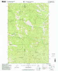
1996 Map of Twin Crags
USGS Topo · Published 1999About this map
Mount Wiessner and the Twin Crags dominate the rugged crest of the St Joe Divide, where the boundaries of Kootenai, Shoshone, and Benewah counties converge. This interior mountain landscape, largely encompassed by the Coeur d' Alene National Forest and St Joe National Forest, reflects a history of high-altitude resource extraction and fire surveillance. The Frost Peak Lookout sits atop Frost Peak, providing a clear vantage point over a drainage network that includes Cataldo Gulch and Pine Creek. Evidence of early mining efforts is visible at the Palisade Mine and various scattered prospects and adits, particularly along the West Fork Pine Creek. The presence of Mirror Lake near the western peaks suggests the pocket of recreational interest amidst this industrial and conservation-focused terrain.
Find a feature on this map
36 named features on this map. Tap any name to fly to it.
Don’t see what you’re looking for? This feature index may not catch every label — zoom into the map to look around manually.
Map Details
Editions of this 1996 Twin Crags Map
This is the sole edition of this map. No revisions or reprints were ever made.
Other maps of this area

1909 · Cataldo
USGS Topo · 1:125,000

1911 · Cataldo
USGS Topo · 1:125,000

1950 · Rochat Peak
USGS Topo · 1:24,000

1950 · Twin Crags
USGS Topo · 1:24,000

1952 · Rochat Peak
USGS Topo · 1:24,000

1952 · Twin Crags
USGS Topo · 1:24,000

1955 · Spokane
USGS Topo · 1:250,000

1957 · Kingston
USGS Topo · 1:62,500

1957 · Kellogg
USGS Topo · 1:62,500

1957 · Calder
USGS Topo · 1:62,500