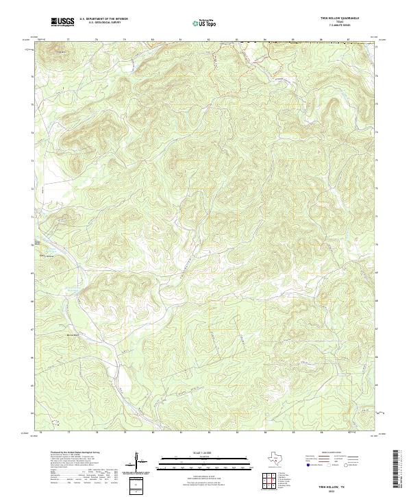
2022 Map of Twin Hollow
USGS Topo · Published 2022About this map
Flag Mtn and Eagle Bluff anchor the limestone heights of this Medina County landscape, where the Balcones Escarpment's broken terrain dictates the path of every road and creek. The area is defined by its drainages, with the significant carving of Twin Hollow and Turkey Hollow leading toward the winding course of Hondo Creek. Rare water features like Mustang Waterhole and Wide Crossing Waterhole suggest historical gathering points in a landscape where reliable water was the primary driver of settlement and movement. Ranching routes like Davenport Ranch Rd and Hoesen Ranch Rd thread through the hills, while newer recreation paths including the Medina Loop Trl and Heritage Loop Trl follow the high ridges between Bandera Cr and W Verde Cr.
Find a feature on this map
42 named features on this map. Tap any name to fly to it.
Don’t see what you’re looking for? This feature index may not catch every label — zoom into the map to look around manually.
Map Details
Editions of this 2022 Twin Hollow Map
This is the sole edition of this map. No revisions or reprints were ever made.
Other maps of this area

1954 · San Antonio
USGS Topo · 1:250,000

1956 · Sabinal
USGS Topo · 1:62,500

1956 · New Fountain
USGS Topo · 1:62,500

1956 · Tarpley
USGS Topo · 1:62,500

1956 · Bandera
USGS Topo · 1:62,500

1957 · San Antonio
USGS Topo · 1:250,000

1964 · Bandera
USGS Topo · 1:24,000

1964 · Timber Creek
USGS Topo · 1:24,000
1964 · Tarpley
USGS Topo · 1:24,000
1964 · Tarpley Pass
USGS Topo · 1:24,000