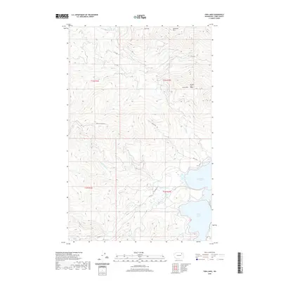
2020 Map of Twin Lakes
USGS Topo · Published 2020About this map
North Twin Lake and South Twin Lake dominate the eastern edge of this landscape in Ferry County, where the topography rises sharply into the high ridges of the Colville Indian Reservation. The map documents a complex drainage system defined by Beaver Dam Cr and Granite Cr, which flow through the steep terrain between Oregon City Ridge and Carson Mtn.
Find a feature on this map
21 named features on this map. Tap any name to fly to it.
Don’t see what you’re looking for? This feature index may not catch every label — zoom into the map to look around manually.
Map Details
Editions of this 2020 Twin Lakes Map
This is the sole edition of this map. No revisions or reprints were ever made.
Other maps of this area

1948 · Wilmont Creek
USGS Topo · 1:62,500

1950 · Wilmont Creek
USGS Topo · 1:62,500

1952 · Keller
USGS Topo · 1:62,500

1952 · Twin Lakes
USGS Topo · 1:62,500

1953 · Seventeenmile Mtn.
USGS Topo · 1:62,500

1954 · Okanogan
USGS Topo · 1:250,000

1956 · Wilmont Creek
USGS Topo · 1:62,500

1958 · Okanogan
USGS Topo · 1:250,000

1984 · Nespelem
USGS Topo · 1:100,000
1985 · Moon Mountain
USGS Topo · 1:24,000