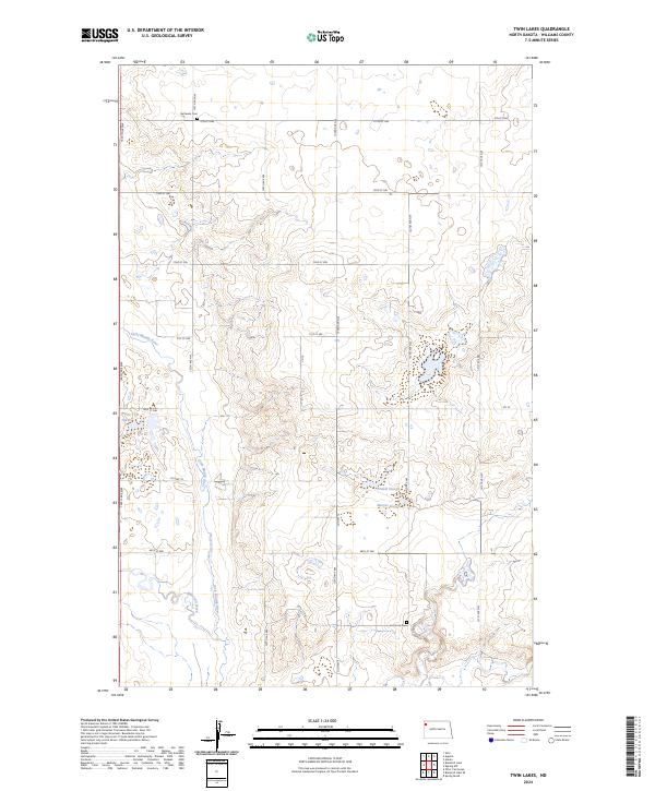
2024 Map of Twin Lakes
USGS Topo · Published 2024About this map
The Little Muddy River winds through this Williams County landscape, carving a valley between the upland plateaus of northwestern North Dakota. The area is defined by its glacial prairie potholes and wetland depressions, most notably the Williams County Waterfowl Production Area which surrounds the eponymous Twin Lakes. This 2024 survey reflects a rural township structure organized by a rigid grid of local roads like 135th Ave NW and 70th St NW. For genealogists and local historians, the map identifies key community anchors including Bethesda Cem in the north and East Fork Cem near the southern boundary. Significant hydrological features such as Erdahl Slough, Marple Slough, and the southern reach of Blacktail Creek illustrate the natural drainage patterns that have historically shaped land use and conservation efforts in this Missouri Plateau region.
Find a feature on this map
27 named features on this map. Tap any name to fly to it.
Don’t see what you’re looking for? This feature index may not catch every label — zoom into the map to look around manually.
Map Details
Editions of this 2024 Twin Lakes Map
This is the sole edition of this map. No revisions or reprints were ever made.
Other maps of this area

1911 · Ray
USGS Topo · 1:125,000

1948 · Zahl
USGS Topo · 1:24,000

1953 · Williston
USGS Topo · 1:250,000

1957 · Williston
USGS Topo · 1:250,000

1959 · Marmon SE
USGS Topo · 1:24,000

1974 · Blacktail Lake
USGS Topo · 1:24,000

1974 · Otter Tail Creek
USGS Topo · 1:24,000

1974 · Twin Lakes
USGS Topo · 1:24,000

1977 · Appam
USGS Topo · 1:24,000

1977 · Alamo
USGS Topo · 1:24,000