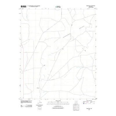
2010 Map of Twin Mesa
USGS Topo · Published 2010About this map
Gerhardt Valley defines this expansive landscape in De Baca County, where the high plains of New Mexico are marked by a network of ranching homesteads and intermittent watercourses. The map traces the path of Truchas Creek and Red Tank Creek as they wind through the terrain, supporting local operations like Wright Ranch and Powell Ranch. This 2010 survey details the essential rural infrastructure of the era, from the elevated relief of Twin Mesa to the distinct network of county roads such as County Rd 3-19 and House Cap Rd that connect isolated properties. Researchers will find a preserved look at modern land use in a region where cattle ranching remains the primary activity, evidenced by the scattered presence of Morgan Ranch, Buckeye Ranch, and Koll Ranch.
Find a feature on this map
22 named features on this map. Tap any name to fly to it.
Don’t see what you’re looking for? This feature index may not catch every label — zoom into the map to look around manually.
Map Details
Editions of this 2010 Twin Mesa Map
This is the sole edition of this map. No revisions or reprints were ever made.
Other maps of this area

1954 · Fort Sumner
USGS Topo · 1:250,000

1958 · Fort Sumner
USGS Topo · 1:250,000

1965 · Fort Sumner West
USGS Topo · 1:24,000

1965 · Windmill Draw
USGS Topo · 1:24,000

1966 · Colorado Canyon
USGS Topo · 1:24,000

1968 · Hassell
USGS Topo · 1:24,000

1968 · Twin Mesa NW
USGS Topo · 1:24,000

1968 · Fort Sumner East
USGS Topo · 1:24,000

1968 · Candy Mesa
USGS Topo · 1:24,000

1968 · Taiban
USGS Topo · 1:24,000