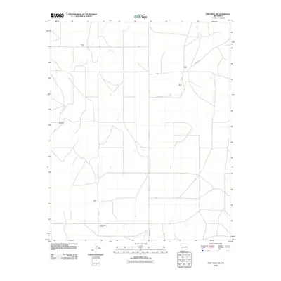
2010 Map of Twin Mesa NW
USGS Topo · Published 2010About this map
Arroyo de Anil meanders across this high plains landscape of De Baca County, defining the drainage patterns in an area primarily dedicated to large-scale ranching operations. The map documents a sparsely populated region where life and livelihood are organized around established family holdings, including the Weaver Ranch to the north and the Jones Ranch further south. A network of county and secondary roads, such as County Rd-3-19 and B 048, connects these remote outposts across the arid terrain. For those researching local history or genealogy, the presence of the Locust Grove Cemetery near the southern boundary serves as a significant landmark of early settlement in this part of New Mexico. The map illustrates the 21st-century continuity of a ranching economy that has long characterized the geography of the southwest.
Find a feature on this map
20 named features on this map. Tap any name to fly to it.
Don’t see what you’re looking for? This feature index may not catch every label — zoom into the map to look around manually.
Map Details
Editions of this 2010 Twin Mesa NW Map
This is the sole edition of this map. No revisions or reprints were ever made.
Other maps of this area

1954 · Fort Sumner
USGS Topo · 1:250,000

1958 · Fort Sumner
USGS Topo · 1:250,000

1964 · Canada Colorado
USGS Topo · 1:24,000

1965 · Windmill Draw
USGS Topo · 1:24,000

1966 · Colorado Canyon
USGS Topo · 1:24,000

1968 · Hassell
USGS Topo · 1:24,000

1968 · Twin Mesa NW
USGS Topo · 1:24,000

1968 · Ima SE
USGS Topo · 1:24,000

1968 · Candy Mesa
USGS Topo · 1:24,000

1968 · Twin Mesa
USGS Topo · 1:24,000