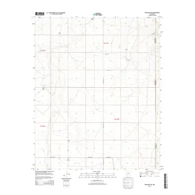
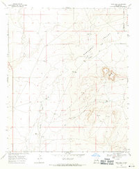
2013 Map of Twin Mesa NW
USGS Topo · Published 2013About this map
The high plains of eastern New Mexico are defined by a network of ranching properties and seasonal watercourses in this 2013 survey. Family-held land is prominent across the landscape, including the Weaver Ranch, Carter Ranch, and Bailey Ranch. The geography is carved by the Arroyo de Anil, which snakes through the western sections of the quadrangle, while the north-south depression of Jackson Draw provides a central drainage corridor. Settlement is sparse and focused on rural residency, with the Locust Grove Cem standing as a significant genealogical marker near the intersection of White Mesa Rd and Gerhardt Rd. To the north, the terrain is accessed via Caprock Rd, illustrating the enduring ranching economy of De Baca County at the turn of the 21st century.
Find a feature on this map
17 named features on this map. Tap any name to fly to it.
Don’t see what you’re looking for? This feature index may not catch every label — zoom into the map to look around manually.
Map Details
Editions of this 2013 Twin Mesa NW Map
This is the sole edition of this map. No revisions or reprints were ever made.
Other maps of this area

1954 · Fort Sumner
USGS Topo · 1:250,000

1958 · Fort Sumner
USGS Topo · 1:250,000
1964 · Canada Colorado
USGS Topo · 1:24,000
1965 · Windmill Draw
USGS Topo · 1:24,000
1966 · Colorado Canyon
USGS Topo · 1:24,000
1968 · Hassell
USGS Topo · 1:24,000
1968 · Twin Mesa NW
USGS Topo · 1:24,000
1968 · Ima SE
USGS Topo · 1:24,000
1968 · Candy Mesa
USGS Topo · 1:24,000
1968 · Twin Mesa
USGS Topo · 1:24,000