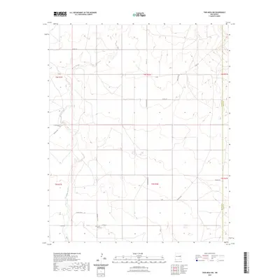
2023 Map of Twin Mesa NW
USGS Topo · Published 2023About this map
Locust Grove Cem provides a focal point for genealogy and local history within this rural De Baca County landscape, situated near the intersection of Locust Grove RD and Co RD 3-24. The terrain is defined by the winding course of the Arroyo de Anil, which cuts through the high plains and mesas of eastern New Mexico. This modern survey reflects the enduring grid of the Public Land Survey System, showing the townships of t6n r26e and t5n r26e. The transportation network consists of straight-line section roads and more fluid tracks like Jackson Draw RD and Dancing RD, which navigate the natural drainage patterns. The boundary with Quay County is clearly marked on the eastern edge of the quadrangle, illustrating the political geography of the Llano Estacado region.
Find a feature on this map
20 named features on this map. Tap any name to fly to it.
Don’t see what you’re looking for? This feature index may not catch every label — zoom into the map to look around manually.
Map Details
Editions of this 2023 Twin Mesa NW Map
This is the sole edition of this map. No revisions or reprints were ever made.
Other maps of this area

1954 · Fort Sumner
USGS Topo · 1:250,000

1958 · Fort Sumner
USGS Topo · 1:250,000

1964 · Canada Colorado
USGS Topo · 1:24,000

1965 · Windmill Draw
USGS Topo · 1:24,000

1966 · Colorado Canyon
USGS Topo · 1:24,000

1968 · Hassell
USGS Topo · 1:24,000

1968 · Twin Mesa NW
USGS Topo · 1:24,000

1968 · Ima SE
USGS Topo · 1:24,000

1968 · Candy Mesa
USGS Topo · 1:24,000

1968 · Twin Mesa
USGS Topo · 1:24,000