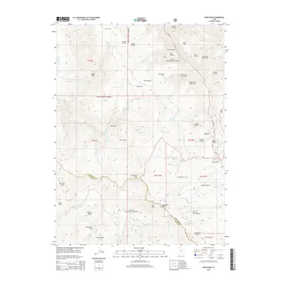
2014 Map of Twin Peaks
USGS Topo · Published 2014About this map
Strawberry Peak and the high ridges of the Wasatch Range dominate this landscape within the Uinta National Forest. The map documents a critical drainage and transit corridor through Daniels Canyon, where US Hwy 40 climbs toward Daniels Pass. The complex topography is defined by numerous family-named and descriptive hollows, such as McGuire Hollow, Thornton Hollow, and Foreman Hollow, indicating a history of localized grazing or timber activity. Water resources are managed via the Highline Canal and landmarks like Harris Reservoir. For researchers, the map provides a precise look at the interface between Wasatch and Utah counties, following the crest of Strawberry Ridge. Notable recreational and geographic points including the Lodge Pole Campground and the namesake Twin Peaks are clearly marked amidst the network of forks and springs that feed Hobble Creek.
Find a feature on this map
65 named features on this map. Tap any name to fly to it.
Don’t see what you’re looking for? This feature index may not catch every label — zoom into the map to look around manually.
Map Details
Editions of this 2014 Twin Peaks Map
This is the sole edition of this map. No revisions or reprints were ever made.
Other maps of this area
1885 · Salt Lake
USGS Topo · 1:250,000
1907 · Strawberry Valley
USGS Topo · 1:125,000
1909 · Strawberry Valley
USGS Topo · 1:125,000
1954 · Salt Lake City
USGS Topo · 1:250,000
1958 · Salt Lake City
USGS Topo · 1:250,000
1960 · Salt Lake City
USGS Topo · 1:250,000
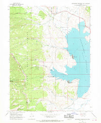
1966 · Strawberry Reservoir NW
USGS Topo · 1:24,000
1966 · Charleston
USGS Topo · 1:24,000
1967 · Two Tom Hill
USGS Topo · 1:24,000
1967 · Granger Mtn
USGS Topo · 1:24,000