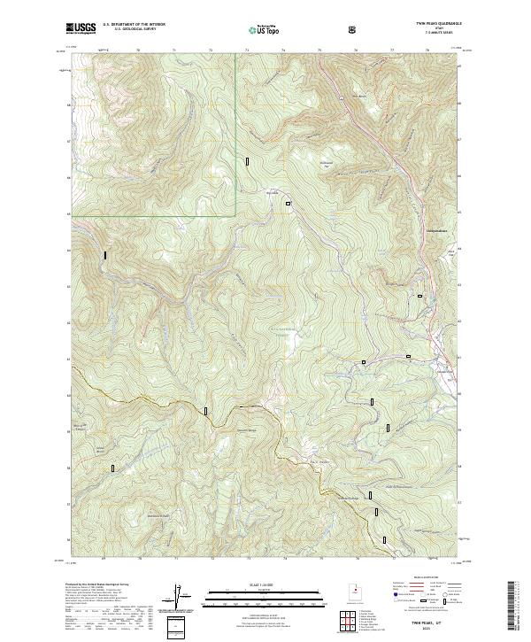
2023 Map of Twin Peaks
USGS Topo · Published 2023About this map
Independence sits along the eastern edge of this landscape, marking a point of settlement near the high mountain crossing of Daniels Pass. The terrain is defined by the sharp divides of the Wasatch Range, where numerous drainage systems like Main Creek and the Left Fork Hobble Creek have carved deep canyons and hollows. Modern recreational use is evident through a network of established paths, including the Clyde Creek Loop Snowmo Groomed Trl and the Daniels Summit Connector Ski Trl. Within the Uinta National Forest, significant peaks such as Strawberry Peak and Twin Peaks rise above the complex system of ridges and flats. Water sources are frequent throughout the high country, with named features such as Willow Spring and Second Set Spring punctuating the slopes above Station Hollow and Pete Canyon.
Find a feature on this map
65 named features on this map. Tap any name to fly to it.
Don’t see what you’re looking for? This feature index may not catch every label — zoom into the map to look around manually.
Map Details
Editions of this 2023 Twin Peaks Map
This is the sole edition of this map. No revisions or reprints were ever made.
Other maps of this area

1885 · Salt Lake
USGS Topo · 1:250,000

1907 · Strawberry Valley
USGS Topo · 1:125,000

1909 · Strawberry Valley
USGS Topo · 1:125,000

1954 · Salt Lake City
USGS Topo · 1:250,000

1958 · Salt Lake City
USGS Topo · 1:250,000

1960 · Salt Lake City
USGS Topo · 1:250,000

1966 · Strawberry Reservoir NW
USGS Topo · 1:24,000
1966 · Charleston
USGS Topo · 1:24,000

1967 · Two Tom Hill
USGS Topo · 1:24,000
1967 · Granger Mtn
USGS Topo · 1:24,000