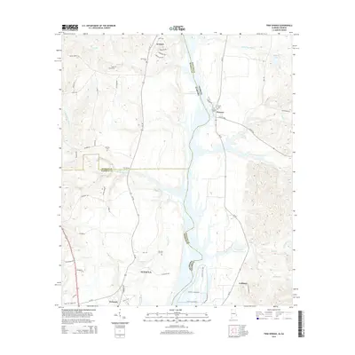
2014 Map of Twin Springs
USGS Topo · Published 2014About this map
Walter F George Reservoir dominates the eastern boundary of this survey, defining the border between Alabama and Georgia as it flows past the small communities of Florence and Jernigan. The landscape is characterized by its hydrological network, with the reservoir fed by numerous tributaries such as Cliatt Br and Little Barbour Cr. This 2014 representation captures the transition from the rolling terrain near Eufaula to the structured water management systems further east, including the First Cross Levee and Second Cross Levee near Coffinton.
Find a feature on this map
65 named features on this map. Tap any name to fly to it.
Don’t see what you’re looking for? This feature index may not catch every label — zoom into the map to look around manually.
Map Details
Editions of this 2014 Twin Springs Map
This is the sole edition of this map. No revisions or reprints were ever made.
Other maps of this area

1949 · Julia
USGS Topo · 1:24,000

1950 · Lumpkin SW
USGS Topo · 1:24,000

1950 · Lumpkin
USGS Topo · 1:62,500

1953 · Dothan
USGS Topo · 1:250,000

1954 · Dothan
USGS Topo · 1:250,000

1955 · Dothan
USGS Topo · 1:250,000

1955 · Lumpkin SW
USGS Topo · 1:24,000
1955 · Union
USGS Topo · 1:24,000

1955 · Lumpkin
USGS Topo · 1:62,500

1955 · Phenix City
USGS Topo · 1:250,000