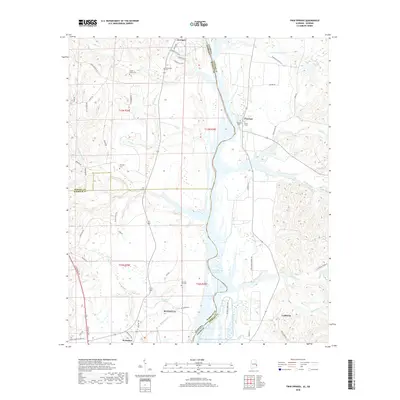
2018 Map of Twin Springs
USGS Topo · Published 2018About this map
The Walter F George Reservoir forms a broad watery boundary between Alabama and Georgia in this 2018 survey, defining the landscape around Eufaula and the rural communities of Twin Springs and Florence. The map documents a territory rich in local history, marked by small family and community burial grounds such as Union Grove Cem, McClendon Cem, and Old Zion Hill Cem. These sites, along with Trinity Cem and Florence Cem, provide critical touchstones for genealogists tracing roots in Barbour and Russell Counties. The landscape transition from the reservoir’s edge to the inland woods is carved by numerous watercourses, including Little Barbour Cr, Cool Br, and Talipahoga Rum Cr. Settlements like Jernigan and Coffinton represent the enduring rural character of this borderland, where modern routes like N Eufaula Ave meet quiet country lanes like Artesian Well Trail.
Find a feature on this map
67 named features on this map. Tap any name to fly to it.
Don’t see what you’re looking for? This feature index may not catch every label — zoom into the map to look around manually.
Map Details
Editions of this 2018 Twin Springs Map
This is the sole edition of this map. No revisions or reprints were ever made.
Other maps of this area

1949 · Julia
USGS Topo · 1:24,000

1950 · Lumpkin SW
USGS Topo · 1:24,000

1950 · Lumpkin
USGS Topo · 1:62,500

1953 · Dothan
USGS Topo · 1:250,000

1954 · Dothan
USGS Topo · 1:250,000

1955 · Dothan
USGS Topo · 1:250,000

1955 · Lumpkin SW
USGS Topo · 1:24,000
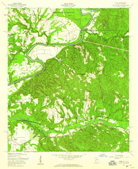
1955 · Union
USGS Topo · 1:24,000

1955 · Lumpkin
USGS Topo · 1:62,500

1955 · Phenix City
USGS Topo · 1:250,000