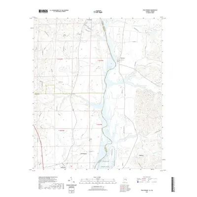
2020 Map of Twin Springs
USGS Topo · Published 2020About this map
The Walter F George Reservoir forms a wide, complex watery border between Alabama and Georgia, dominating the center of this landscape. Along the western banks in Barbour and Russell counties, the terrain is marked by a network of creeks and small drainages like Wylaunee Cr and Cliatt Br that feed into the larger reservoir system. This map captures the area's rural character, where small clusters of settlement such as Twin Springs and Wylaunee are connected by narrow roads winding through the topography.
Find a feature on this map
66 named features on this map. Tap any name to fly to it.
Don’t see what you’re looking for? This feature index may not catch every label — zoom into the map to look around manually.
Map Details
Editions of this 2020 Twin Springs Map
This is the sole edition of this map. No revisions or reprints were ever made.
Other maps of this area

1949 · Julia
USGS Topo · 1:24,000

1950 · Lumpkin SW
USGS Topo · 1:24,000

1950 · Lumpkin
USGS Topo · 1:62,500

1953 · Dothan
USGS Topo · 1:250,000

1954 · Dothan
USGS Topo · 1:250,000

1955 · Dothan
USGS Topo · 1:250,000

1955 · Lumpkin SW
USGS Topo · 1:24,000
1955 · Union
USGS Topo · 1:24,000

1955 · Lumpkin
USGS Topo · 1:62,500

1955 · Phenix City
USGS Topo · 1:250,000