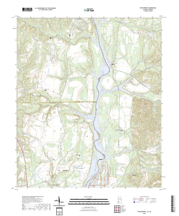
2024 Map of Twin Springs
USGS Topo · Published 2024About this map
The Chattahoochee River defines the border between Alabama and Georgia in this 2024 survey, creating a landscape of riverine wetlands and agricultural transitions. Much of the Southern portion is occupied by the Eufaula National Wildlife Refuge, where the river broadens into the Walter F George Reservoir. Traces of older rural communities are visible through numerous family and congregational burial sites, including the Old Zion Hill Cem and Mount Mckethan Baptist Church Cem. The small settlements of Wylaunee and Coffinton anchor the local road network, while the hydrology of the region is further characterized by Wylaunee Creek and Talipahoga-Rum Creek. This modern record reveals how wildlife conservation and water management have shaped the historic river corridor, preserving landmarks like the Bradley Dike alongside longstanding rural properties.
Find a feature on this map
73 named features on this map. Tap any name to fly to it.
Don’t see what you’re looking for? This feature index may not catch every label — zoom into the map to look around manually.
Map Details
Editions of this 2024 Twin Springs Map
This is the sole edition of this map. No revisions or reprints were ever made.
Other maps of this area

1949 · Julia
USGS Topo · 1:24,000

1950 · Lumpkin SW
USGS Topo · 1:24,000

1950 · Lumpkin
USGS Topo · 1:62,500

1953 · Dothan
USGS Topo · 1:250,000

1954 · Dothan
USGS Topo · 1:250,000

1955 · Dothan
USGS Topo · 1:250,000

1955 · Lumpkin SW
USGS Topo · 1:24,000
1955 · Union
USGS Topo · 1:24,000

1955 · Lumpkin
USGS Topo · 1:62,500

1955 · Phenix City
USGS Topo · 1:250,000