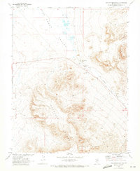
1968 Map of Twin Springs Slough
USGS Topo · Published 1973About this map
Hot Creek Valley serves as a stark focal point for this Nevada survey, where the desert landscape is defined by its vital and scarce water sources. The Twin Springs Ranch sits near the base of the Pancake Range, positioned strategically near a gaging station and seeps that feed into the Twin Springs Slough. This area was mapped in cooperation with the Atomic Energy Commission, reflecting the strategic importance of this high-desert terrain during the late 1960s.
Find a feature on this map
16 named features on this map. Tap any name to fly to it.
Don’t see what you’re looking for? This feature index may not catch every label — zoom into the map to look around manually.
Map Details
Editions of this 1968 Twin Springs Slough Map
This is the sole edition of this map. No revisions or reprints were ever made.
Other maps of this area

1956 · Tonopah
USGS Topo · 1:250,000

1959 · Tonopah
USGS Topo · 1:250,000

1962 · Tonopah
USGS Topo · 1:250,000

1967 · Lunar Crater
USGS Topo · 1:62,500

1967 · Buckwheat Rim
USGS Topo · 1:24,000
1967 · Chuck Wagon Flat
USGS Topo · 1:24,000

1967 · Tybo SE
USGS Topo · 1:24,000

1968 · Tybo
USGS Topo · 1:62,500

1968 · Warm Springs
USGS Topo · 1:62,500
1968 · Reveille
USGS Topo · 1:62,500