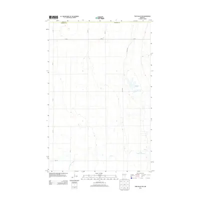
2013 Map of Twin Valley NW
USGS Topo · Published 2013About this map
Lockhart Swamp and the surrounding wetlands of Polk and Norman counties define this portion of the Red River Valley. The landscape is heavily shaped by agricultural water management, evidenced by the presence of State Ditch Number Sixtyeight and Spring Cr. This 2013 survey illustrates a quiet rural expanse where section-line roads like 270th St and 300th St grid the territory between larger natural features and managed lands. The Wildlife Area and Green Meadow Group Pond provide critical habitat in an area otherwise dominated by the geometric layout of county highways and local connectors. For researchers, the map provides a precise record of drainage patterns and public land use in this specific corner of northwest Minnesota.
Find a feature on this map
13 named features on this map. Tap any name to fly to it.
Don’t see what you’re looking for? This feature index may not catch every label — zoom into the map to look around manually.
Map Details
Editions of this 2013 Twin Valley NW Map
This is the sole edition of this map. No revisions or reprints were ever made.
Other maps of this area

1918 · Twin Valley
USGS Topo · 1:62,500

1919 · Beltrami
USGS Topo · 1:62,500

1924 · Ada
USGS Topo · 1:62,500

1952 · Grand Forks
USGS Topo · 1:250,000

1956 · Grand Forks
USGS Topo · 1:250,000

1964 · Beltrami
USGS Topo · 1:24,000

1965 · Lockhart
USGS Topo · 1:24,000

1965 · Fertile
USGS Topo · 1:24,000

1965 · Melvin
USGS Topo · 1:24,000

1965 · Twin Valley SW
USGS Topo · 1:24,000