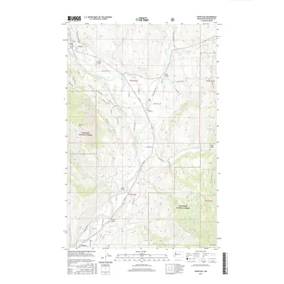
2017 Map of Twisp East
USGS Topo · Published 2017About this map
The Methow River corridor dominates this 2017 survey, tracing a path through the valley between the high peaks of the Okanogan National Forest. At the northern edge, the settlement of Twisp serves as a central hub, flanked by the Twisp Municipal Airport and residential roads like Twisp-Carlton Rd. The landscape is a mix of agricultural valley floors and steep timbered ridges, with numerous named canyons such as Finley Canyon and Leecher Canyon draining into the river system. Local history is anchored by the Beaver Creek Cem and small settlements like Carlton to the south. The area’s geography is defined by significant elevations, including McClure Mtn and Mt Leecher, while smaller water bodies like Thurlow Lake and Warner Lakes Number One dot the high country. Private ranch roads and Forest Service routes provide access to remote landmarks like Port Field and Booth Canyon.
Find a feature on this map
65 named features on this map. Tap any name to fly to it.
Don’t see what you’re looking for? This feature index may not catch every label — zoom into the map to look around manually.
Map Details
Editions of this 2017 Twisp East Map
This is the sole edition of this map. No revisions or reprints were ever made.
Other maps of this area

1899 · Methow
USGS Topo · 1:125,000

1901 · Methow
USGS Topo · 1:125,000

1905 · Okanogan
USGS Topo · 1:125,000

1954 · Okanogan
USGS Topo · 1:250,000

1955 · Concrete
USGS Topo · 1:250,000

1956 · Loup Loup
USGS Topo · 1:62,500

1957 · Brewster
USGS Topo · 1:62,500

1958 · Concrete
USGS Topo · 1:250,000

1958 · Okanogan
USGS Topo · 1:250,000

1962 · Concrete
USGS Topo · 1:250,000