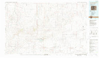
1984 Map of Two Buttes Reservoir
USGS Topo · Published 1984About this map
The Santa Fe Trail cuts through this high plains landscape of southeastern Colorado and western Kansas, tracing a path of westward migration across the drainages of Caddoa Creek and Two Buttes Creek. In the 1980s, the region was defined by its vast cattle ranching and dryland farming tracts, anchored by the Two Buttes State Wildlife Area and the vital waters of the Two Buttes Reservoir.
Find a feature on this map
39 named features on this map. Tap any name to fly to it.
Don’t see what you’re looking for? This feature index may not catch every label — zoom into the map to look around manually.
Map Details
Editions of this 1984 Two Buttes Reservoir Map
This is the sole edition of this map. No revisions or reprints were ever made.
Other maps of this area

1890 · Granada
USGS Topo · 1:125,000

1891 · Albany
USGS Topo · 1:125,000

1891 · Higbee
USGS Topo · 1:125,000

1891 · Las Animas
USGS Topo · 1:125,000

1891 · Springfield
USGS Topo · 1:125,000

1892 · Lamar
USGS Topo · 1:125,000

1892 · Vilas
USGS Topo · 1:125,000

1892 · Granada
USGS Topo · 1:125,000

1892 · Two Butte
USGS Topo · 1:125,000

1892 · Mt Carrizo
USGS Topo · 1:125,000