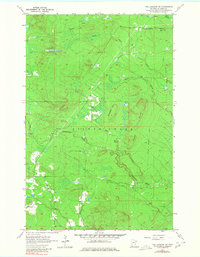
1957 Map of Two Harbors NE
USGS Topo · Published 1980About this map
Gooseberry River and the Encampment River carve through the heavily forested landscape of Lake County, defining the drainage patterns south of the Bluffs. This mid-century survey illustrates a region largely shaped by the timber industry and early infrastructure, evidenced by the prominent Old Railroad Grade that winds through the northern sections near Beaver Crossing. Small settlements like London appear alongside geographic markers such as Gustafson Hill and the extensive Murphy Swamp.
Find a feature on this map
18 named features on this map. Tap any name to fly to it.
Don’t see what you’re looking for? This feature index may not catch every label — zoom into the map to look around manually.
Map Details
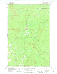
Editions of this 1957 Two Harbors NE Map
3 editions found
Other maps of this area

1953 · Whyte
USGS Topo · 1:62,500

1954 · Silver Bay
USGS Topo · 1:62,500

1954 · Two Harbors
USGS Topo · 1:250,000

1956 · Split Rock Point
USGS Topo · 1:24,000

1956 · Split Rock Point
USGS Topo · 1:62,500

1957 · Two Harbors
USGS Topo · 1:250,000

1957 · Two Harbors
USGS Topo · 1:62,500

1957 · Two Harbors
USGS Topo · 1:24,000

1957 · Two Harbors NE
USGS Topo · 1:24,000

1957 · Castle Danger
USGS Topo · 1:24,000